
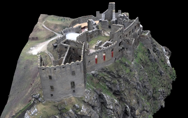
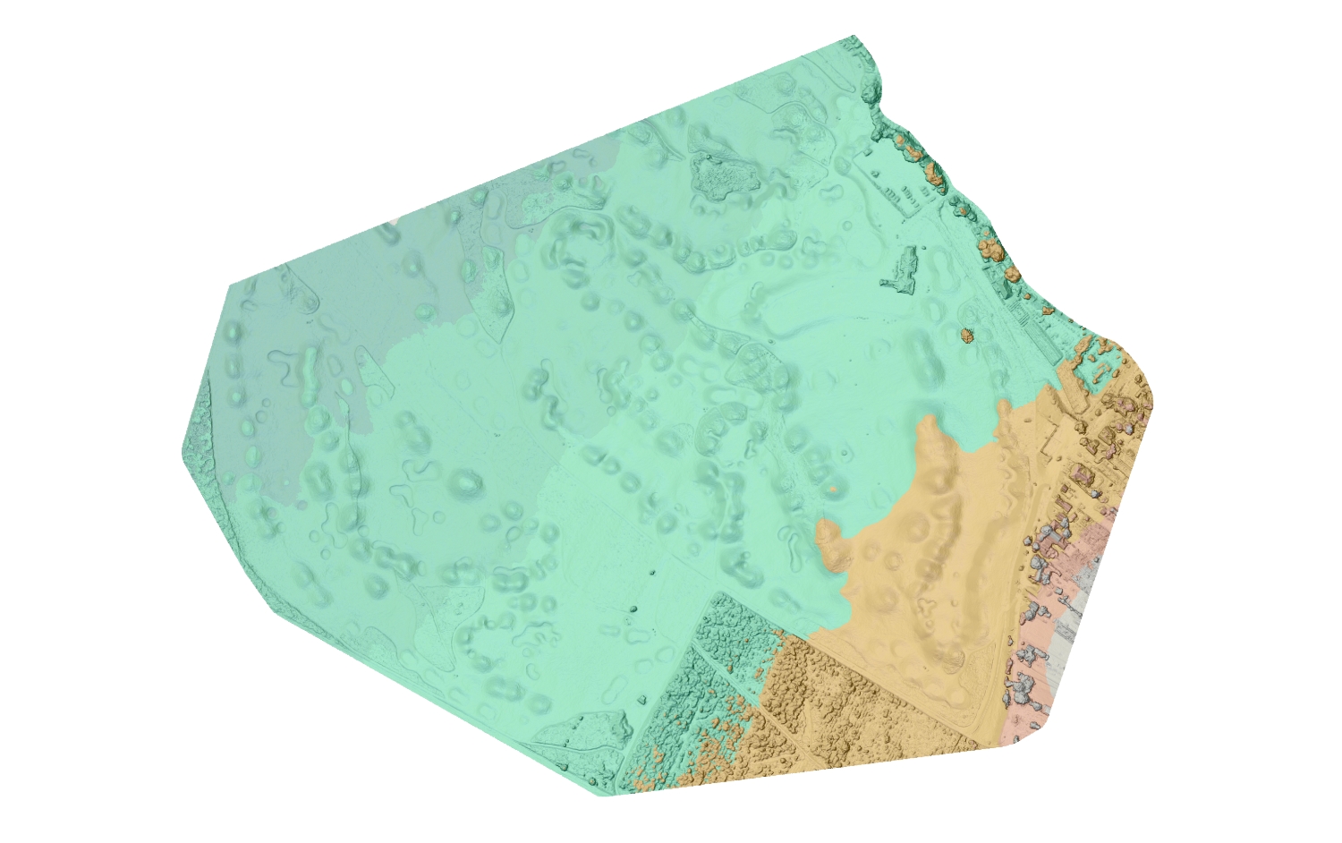
3D mapping can be used in documentation of cultural heritage, uncovering archaeological sites, technical documentation of buildings (3D passport), monitoring of changes and displacements, calculation of volumes, creation of 3D maps, DEM, DTM, and orthophotomaps of larger territorial units, mapping of highways and streets, digitization of buildings and cities.
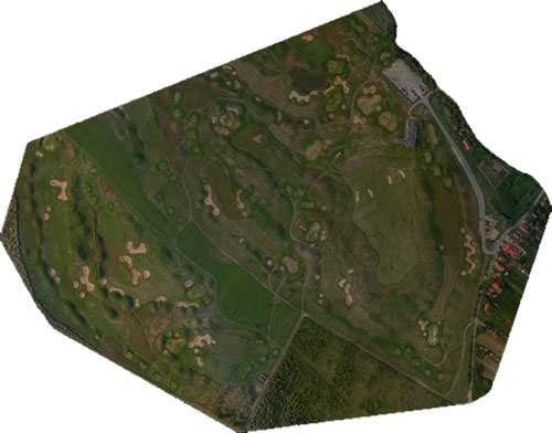
Stages of 3D mapping
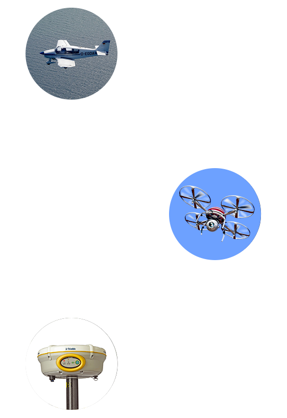
Aerial photogrammetry
We use this technology primarily for mapping of larger territorial units. For this purpose we have developed a platform with four cameras placed on an aircraft carrier.
UAS / UAV
For mapping of smaller areas and buildings in cities where higher details resolution is required, we use Unmanned Aerial Systems equipped with cameras. The data are supplemented by Close-Range photogrammetry, or data from laser scanning, as needed.
GNSS measurement
These measurements are made using GNSS receivers, and are required for acquiring GCPs. Number of these points depends on the extent of mapped area, and they are used for georeferencing of the model.
Cutting edge technology
We use cutting edge technology of Aerial and Close-Range photogrammetry, Laser scanning and Unmanned Aerial Systems (UAS) to collect data. The advantage of these technologies is that they represent contactless scanning methods. It means that the surface of measured object (landfill, embankment) does not get damaged due to influence of measurement device or its service that could potentially cause altering of object shape. It is also possible to measure inaccessible places or places with hazardous material. A considerable advantage is that fieldwork is fast and therefore does impose time restrictions for other building processes in given area. Thanks to these technologies we are able to capture even small details and surface of building deformations.
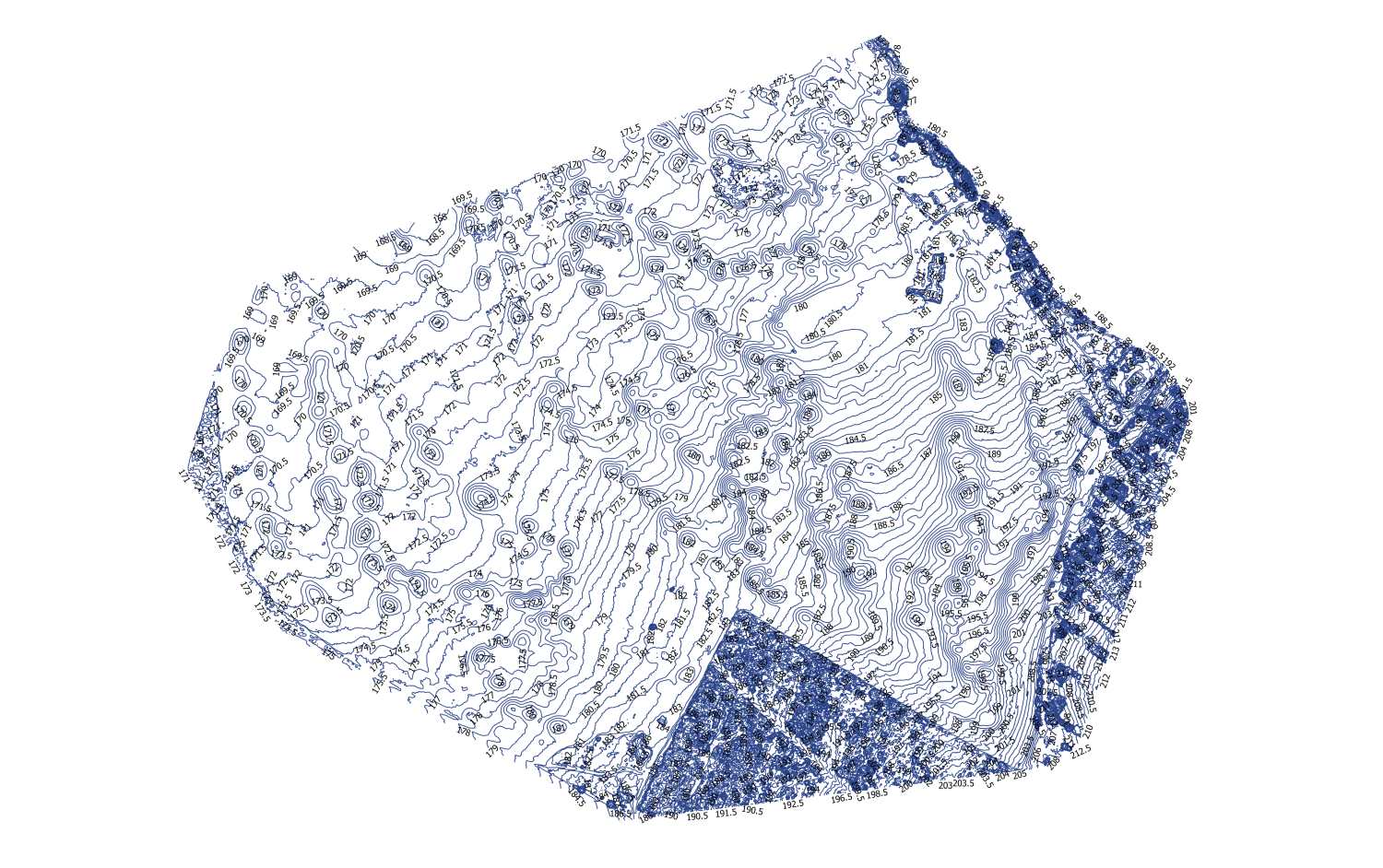
Outputs
For instance, we can uses the outputs to draw up vector documentation, perform measurements and calculations of volumes, or create cuts, as required.
Based on 3D models we can develop various animations, such as bird-eye view or stereoscopic videos for presentation purposes. Upon request, we optimize 3D models and prepare them for presentation using virtual and augmented reality.
Please do not hesitate to get in touch with us if you have any questions regarding support or other outputs or formats.
Samples of our works
The procedure of solution drafting
1. MEETING
Meeting for a coffee in our office. Together we will define the objective of the project.
2. PLANNING
We will set up a schedule of tasks, and choose the best possible technology for your project.
3. SCANNING
We will proceed with scanning of an object in question using appropriate technology.
4. PROCESSING
We will develop a 3D model and calculate required data for your project.
5. DELIVERY
We deliver the final project to a client in a specified format.

We are here for you!
Did our experience and unique solutions catch your attention? Do not hesitate to get in touch with us, and become one of our satisfied clients.